AkinOstrich
New Member
Hi everybody!
Here's a link to something I just found recently. I've worked with LiDAR data before, alas the places I want to work on are surrounded by forest, and I was never successful (mostly because their were 1+ million vertices to work with, so pc was too slow at sculpting). Here's an idea of what I was trying to work with:

Some (if not all) of the road would be covered with spikes and annoying misplaced vertices. I was needless to say very frustrated, but I came back a year later to try again. I used many different websites for LiDAR data, and I've finally found something that really works well. It's called OpenTopography (https://portal.opentopography.org/datasets), and it's really got me inspired to keep working on a road I've desired to recreate for a while now.
Unfortunately, it does not cover all of the U.S., but each year they add on more and more counties. Hopefully one day, if not now, they'll have an area you're looking for. Unfortunately, you need a valid educational email (.edu) to download LiDAR data (that may change in the future).
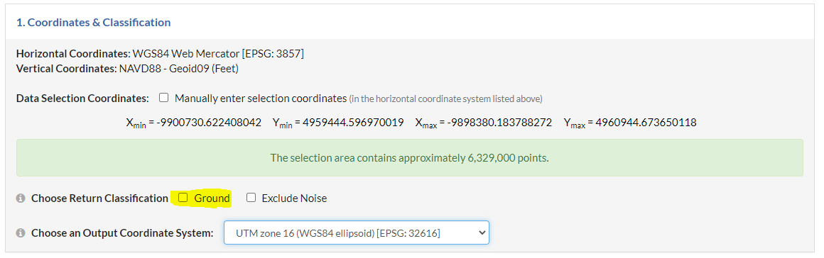
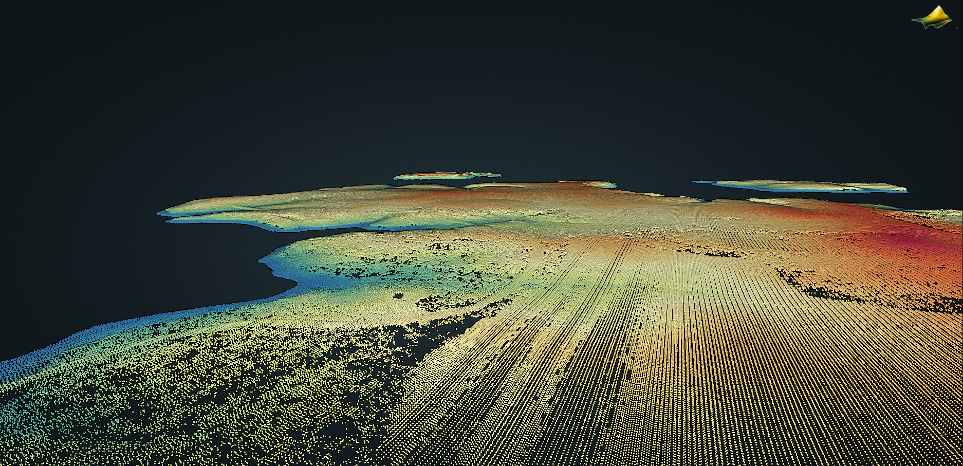
The secret ingredient to getting a fantastic terrain is under coordinates & classification. You must check the "Ground" checkbox classification in order to exclude trees and buildings. Naturally, It will leave those gaps unfilled. You can even do a visualization of the point cloud if you wish to see it. Here's what mine looked like:
What's great about this is that I can use the LiDAR mesh to get the road's camber and curvature accurate! However, what I still have trouble with is the mesh optimization. Obviously, what the driver cannot see does not matter, but it would still be troublesome to try to cut out tiny pieces of the road to try to fit under the 56k vertice limit. If anybody has any ideas besides making a separate mesh with a lower resolution and shrink-wrapping it to the LiDAR mesh please comment!
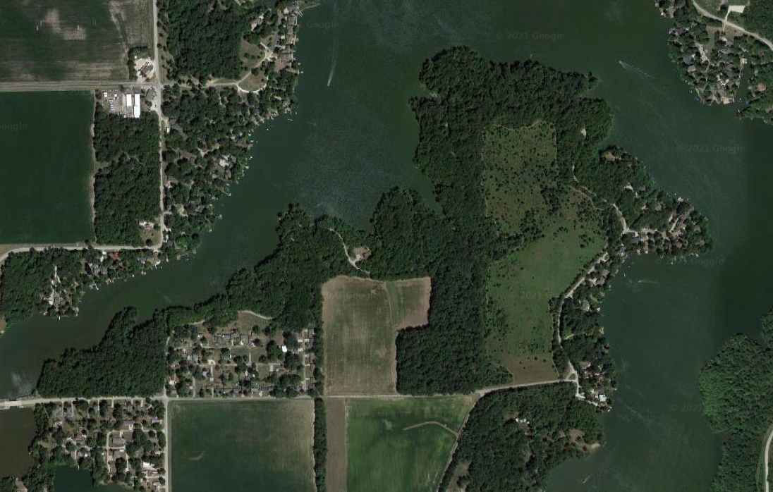
Here's a Google Image of the terrain I'm working with. Obtained from http://www.chengfolio.com/google_map_customizer#satellitemap
Here's a link to something I just found recently. I've worked with LiDAR data before, alas the places I want to work on are surrounded by forest, and I was never successful (mostly because their were 1+ million vertices to work with, so pc was too slow at sculpting). Here's an idea of what I was trying to work with:
Some (if not all) of the road would be covered with spikes and annoying misplaced vertices. I was needless to say very frustrated, but I came back a year later to try again. I used many different websites for LiDAR data, and I've finally found something that really works well. It's called OpenTopography (https://portal.opentopography.org/datasets), and it's really got me inspired to keep working on a road I've desired to recreate for a while now.
Unfortunately, it does not cover all of the U.S., but each year they add on more and more counties. Hopefully one day, if not now, they'll have an area you're looking for. Unfortunately, you need a valid educational email (.edu) to download LiDAR data (that may change in the future).
The secret ingredient to getting a fantastic terrain is under coordinates & classification. You must check the "Ground" checkbox classification in order to exclude trees and buildings. Naturally, It will leave those gaps unfilled. You can even do a visualization of the point cloud if you wish to see it. Here's what mine looked like:
What's great about this is that I can use the LiDAR mesh to get the road's camber and curvature accurate! However, what I still have trouble with is the mesh optimization. Obviously, what the driver cannot see does not matter, but it would still be troublesome to try to cut out tiny pieces of the road to try to fit under the 56k vertice limit. If anybody has any ideas besides making a separate mesh with a lower resolution and shrink-wrapping it to the LiDAR mesh please comment!
Here's a Google Image of the terrain I'm working with. Obtained from http://www.chengfolio.com/google_map_customizer#satellitemap
")
